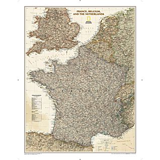
France, Belgium and the Netherlands Political Map (Earth-toned) 30x23
Search in Category
Product Details
alternativeSearches
subCategory
vendor
SKU #
1020459
Price
$20.00
This elegant, richly colored map of France, Belgium, and the Netherlands shows political boundaries, major highways and roads, cities and towns, and a wealth of other geographic details.
•30" x 23"
•Scale = 1:1,953,000