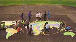
The eight section stencil has holes with define detailed borders of the continents, countries, oceans, and largest lakes of the world
Covers an area 5.5 x 10.5 meters
Scale: 1 meter = 4000 km
Geographical
paint rivers, mountains, lakes, and deserts
Political
show major cities, capitals
Economic
find dams, major crops, products and recources
Scientific
locate species habitats and animal/bird migration routes
Historical
draw explorer routes, places of historical interest, and historical political borders


